I need a distraction. Time for a new virtual journey, and it's back to civilization, well, comparatively speaking anyway. We are at 37.37° N, 107.83° E. Welcome to the Ordos Desert.
Physical geography:
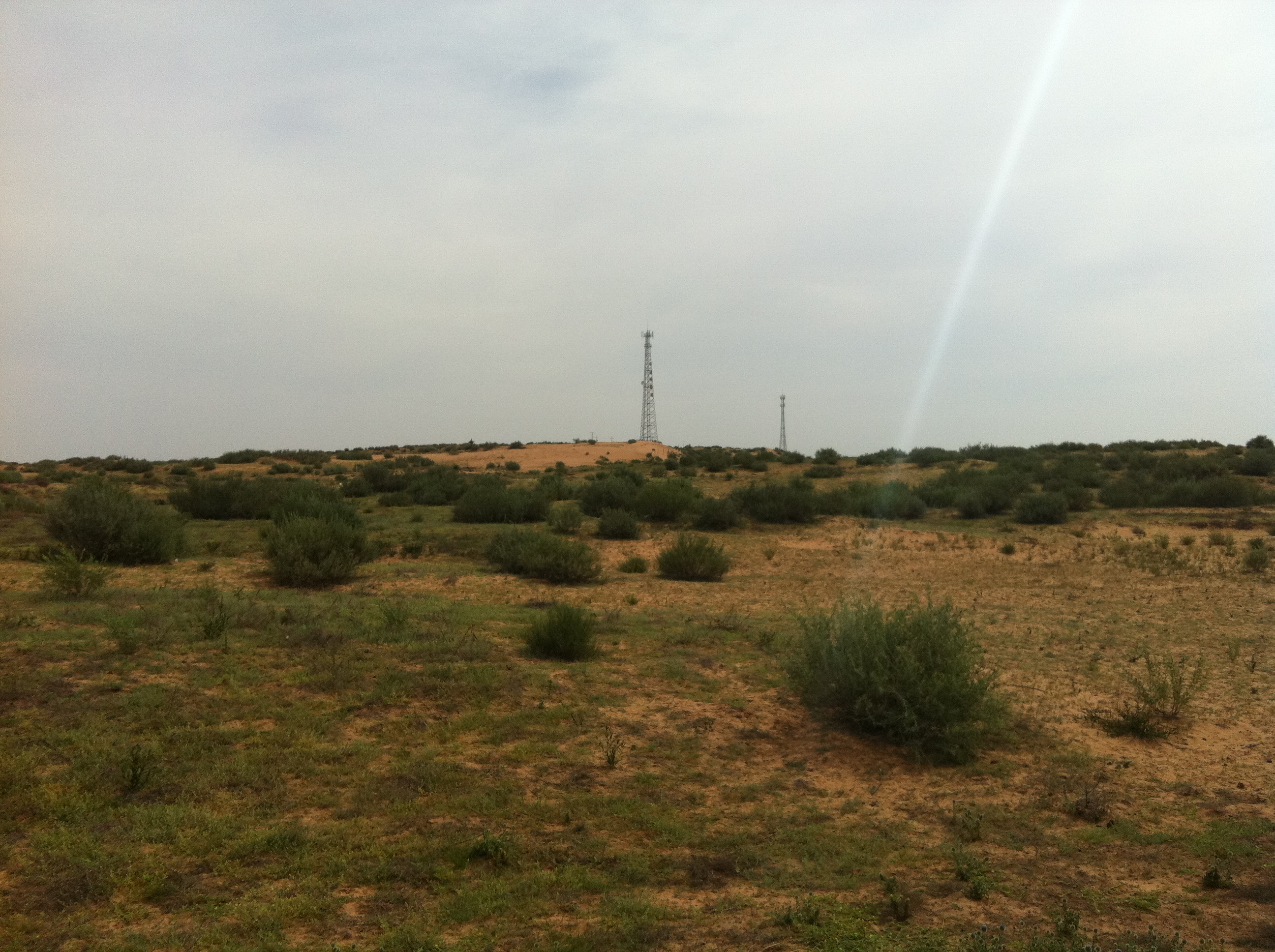
The Ordos desert is separated from the larger Gobi desert by the Yellow River (or more properly, the Huang He) and is contained by a giant loop the river makes (called curiously enough, the Ordos loop). Our point is sandy soils with some sort of grass or shrub covering and probably looks very much like the picture below, minus the power lines. There are some what looks like low rolling hills here, that are vegetated sand dunes, elevation is around 4,600 feet above sea level. Climate is semi-arid and temperate with temperatures in the 70-80° F range in summer and 10-20° F in winter and precipitation is only 10 inches a year, usually in the form of the occasional summer thunderstorm. I couldn't find out too much about the ecology, but would assume you'd have the usual desert critters. Rainfall is so seldom there is no real hydrology to speak of, but we are part of the Yellow river basin. The environment here is not particularly harsh, but the lack of water and sandy soil means it's difficult to grow anything. In ancient times this area was prime grazing land, but overgrazing over the years led to desertification which has been aggravated more recently by climate change.
Human geography:
We are in the People's Republic of China or more specifically the Otog Front Banner (district-level, think county) of Ordos City (prefecture-level, a sub-division between state and county, and don't be fooled by "city" in the name, it is mostly rural and until recently it was the Ikezhao League) of the Inner Mongolia Autonomous Region (province-level, think state). The use of Banner and League terminology as sub-divisions are holdovers from when this area was not part of China proper. Lets start in the beginning.
There have been people living here since ancient times, the earliest archaeological finds date to some 35,000 years ago and belong to the Hetao people about whom not much is known. Recorded history of the region really starts with the Xiongnu (or Hsuing-nu) who were a nomadic people that founded an empire that lasted about 400 years, roughly 200 BCE to 200 AD. The Ordos region was often a area of conflict between them and the Qin and Han Chinese dynasties of the time and changed hands several times. The earliest Great Wall of China was built during this time and ran about 30 miles south of our point with the Ordos being on the Xiongnu side. One of the Xiongnu successor states, the Xia, are notable for building the largest pre-modern city the Ordos has seen, Tongwancheng, in the 400's, about 60 miles southeast of our point. It was conquered by the Chinese Wei dynasty in 430. Its ruins are a popular tourist attraction today.
The area was loosely held by a series of Chinese dynasties until the Tang dynasty in 881. The Tangut people had gradually been moving into the area throughout the 600's and 700's, they were a Tibetan-related people fleeing the Tibetan Empire. In 881 the Tang emperor rewarded a Tangut general with the Ordos area in thanks for aiding him against a rebellion. That formed the core of what would become the Western Xia or Tangut empire that would expand to the west and take control of the silk road. This empire lasted until 1227 when it was conquered by the Mongols.
There is a reason you've never heard of the Tanguts. Temüjin (aka Genghis Khan) had unified the Mongols in 1206 and the Tanguts were one of his first targets and they submitted to his rule in 1210. 9 years later when Temüjin embarked on his invasion of Persia the Tanguts refused to contribute any men. When Temüjin returned from his western campaign he proceeding with a new one to punish the Tanguts for their betrayal, invading in 1225 and systemically destroying every city as went. While he was successful in eradicating the Tanguts from history it was also his undoing as he died in taking the final Tangut city of Yinchuan - about 85 miles west of our point.
The history of the area has been linked to Temüjin ever since, he liked the area so much that he vowed he would be buried here. He is not in fact buried here (his burial site is unknown), but after his death the movable palaces that he used became movable mausoleums containing venerated items associated with Temüjin. The name "Ordos" itself is a reference to said mausoleum and the tribe here that came to be known as Ordos Mongols saw themselves as caretakers of Temüjin's legacy. The mausoleum would get a permanent building in 1864 and today remains both a place of worship and veneration for Mongols and a tourist attraction for the rest of the world. It's located about 120 miles northeast of our point.
Temüjin's son, Kublai Khan, would go on to conquer China and found the Yuan dynasty. When the Ming dynasty kicked the Mongols out in 1368 the Yuan continued to rule Mongolia, which then meant everything north of the Great Wall, which would include Ordos. The next 300 years the area was home to the Ordos Mongols. Mongolia doing those years was rarely a unified entity, warfare between the tribes was common, but I won't go into that other than to say that the Ordos were their own tribe, one among many participating in the constant shifting of alliances.
That would end with the Manchu conquest in 1635 that also figured prominently in a couple of our previous points. The Manchus conquered the Mongol tribes before going on to conquer China and forming the Qing dynasty. During the Qing dynasty they maintained separate administrations for "China proper" which continued to use the Ming bureaucracy and the Manchu and Mongol territories which organized areas into "Banners". Banners originally referred to how the Manchu military was structured, with each Banner corresponding to an army. After their conquest each was assigned a territory and the Banners were grouped into Leagues. Through most of the Qing period travel between the two areas was restricted, but they began allowing Han Chinese to settle in the Mongol areas in the late 1800's.

When the Qing collapsed in 1911 there was brief attempt by Mongol leaders to join the newly independent Mongolia, but local warlords took control and Inner Mongolia was eventually forced into the equally new Republic of China. The RoC reorganized the area into provinces, although it's unclear to me how much control the RoC actually had over the area as they were soon consumed by the events of WWII. WWII appears to have been a very confused time for Inner Mongolia with pro-RoC, pro-Mongolia, pro-Communist, and pro-Japanese military units all operating more or less independently. The Japanese did set up a Mongolian puppet state that included Ordos, but it was short lived.
How Inner Mongolia emerged after the war seems to largely due to a man named Ulanhu. He was a communist organizer in the 20's and with WWII he organized military resistance against the Japanese. In the civil war that followed he became one of the premier generals under Mao Zedong and brought Inner Mongolia into the People's Republic of China in 1947 and becoming its Chairman. He was purged during the Cultural Revolution, but survived and was later restored thanks to the personal support of Zhou Enlai. The current Chairperson of Inner Mongolia is his granddaughter, Bu Xiaolin.
Today the area remains very rural, thinly populated (14 people per sq. mile) by a mix of Han Chinese and Mongol peoples (Mongols being 31% of the population of the Banner). The Mongols are well integrated into modern China and do not suffer the same degree of persecution that other ethnic minorities in China do, probably at least in part because Communist China sees Mongol history as an integral part of its own history.
There aren't any people at all right at our point, though there are what look like 4x4 tracks criss-crossing the area. Nearest habitation is about a mile away and looks like a livestock operation of some sort, mostly like sheep. Agriculture, mostly ranching, is the main economic activity. Sheep kept for both wool and mutton being the most popular animal, but cattle, pigs, goats, and horses are kept as well. Further south there are some isolated farms despite the unsuitability, mostly likely wheat and requiring heavy irrigation, the green of them shows up sharply against the desert in the imagery.
Going a little farther afield about 65 miles to the west is a coal mine, mining is relatively near to the area starting a boom around 2000 and making this one of the more prosperous areas of China when looking at a per capita basis. That boom fueled the oddity that is Kangbashi. Ordos City not only doesn't have a city called Ordos, it didn't have any large cities at all, so in 2003 the Chinese began building one from scratch. The boom however was not nearly that much of a boom, originally designed for a million that was soon scaled down to 300,000, and by 2010 it only had around 30,000 people leading the press to call it a ghost town. It has since started to fill out though and today has about 200,000. While that is the capital of the prefecture, it is not the closest city to our point, being about 135 miles away to the northeast.
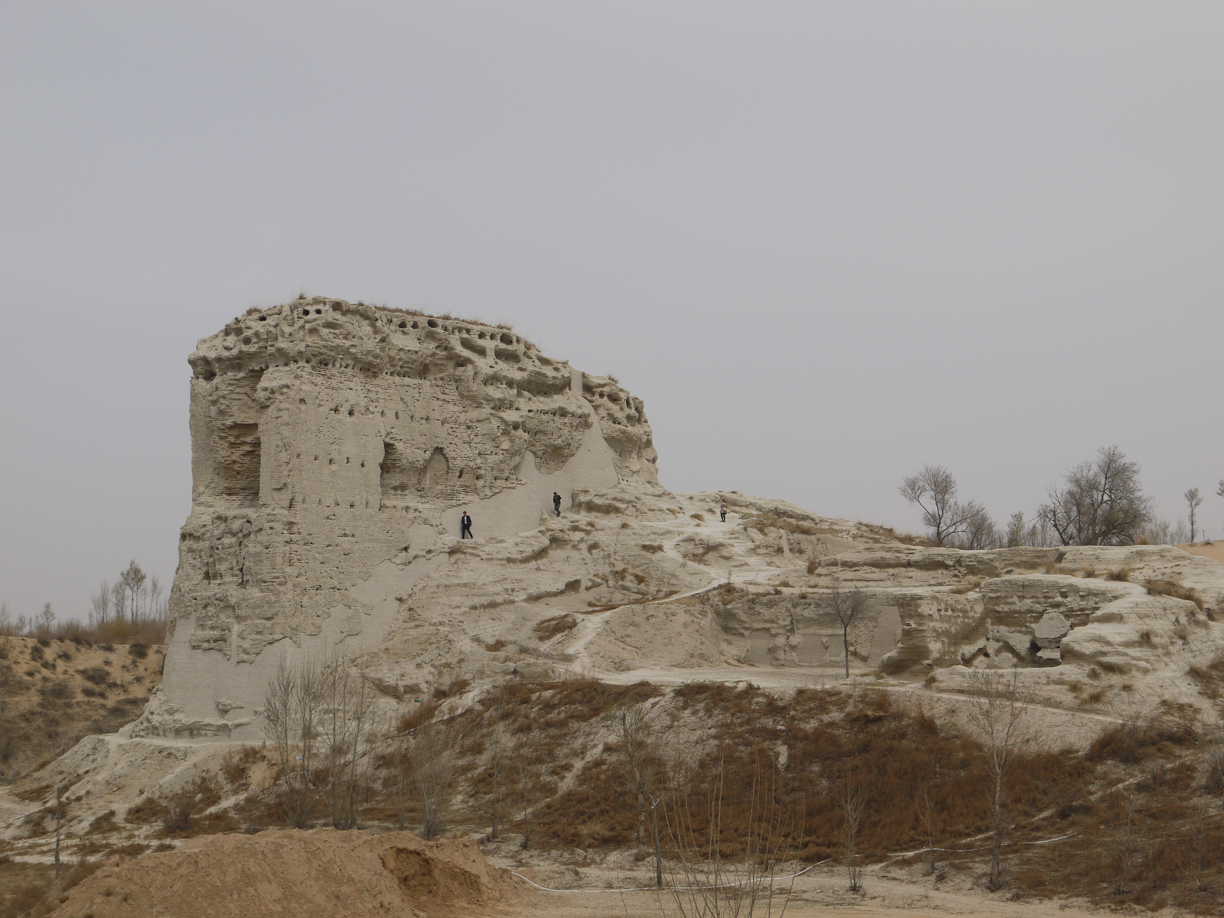
The nearest town of any size is a small village called Maladi about 10 miles away, and then it's about 20 miles to Aolezhaoqi, the town of 26,000 that is the biggest in Otog Front Banner. The nearest big city is Yinchuan, the former capital of the Tanguts, now a sprawling city of 1.5 million in the neighboring Ningxia Hui Region, 80 miles to the west and in the fertile valley of the Yellow River - what I'm sure feels like a different world from our windswept desert. It's different culturally as well being a center of the Hui people, China's Islam minority. Here is where we'd fly into if we were visiting our point.
Image looking across the Yellow River from the Ordos side
Speaking of culture, throughout Inner Mongolia is a mix of Han Chinese and Mongolian culture, inter-marriage is common and it looks like the culture really is a blend of the two rather then there being two separate cultures alongside each other. The language spoken is mostly Mandarin, but Mongolian is spoken as well and most official signs will have both. While the Mongols here have long given up their nomadic ways, that past is still venerated in art and music. And in religion, in fact surveys indicate many of the area Han incorporate elements of traditional Mongolian beliefs alongside the usual mix of traditional Chinese religions. Buddhism among the Mongols evolved into its own particular version derived from Tibetan Buddhism rather than that practiced elsewhere in China, and the Han in the area are more likely to practice this Mongolian Buddhism rather than Chinese Buddhism. Also centered in Ordos is the growing cult of Genghis Khan worship, a neo-shamanistic movement. Traditional fire-worshiping ceremony held annually in Otog Front Banner.
I'll leave you with this cool turn of the century map in which our whole area is just "sandy waste".

Physical geography:
The Ordos desert is separated from the larger Gobi desert by the Yellow River (or more properly, the Huang He) and is contained by a giant loop the river makes (called curiously enough, the Ordos loop). Our point is sandy soils with some sort of grass or shrub covering and probably looks very much like the picture below, minus the power lines. There are some what looks like low rolling hills here, that are vegetated sand dunes, elevation is around 4,600 feet above sea level. Climate is semi-arid and temperate with temperatures in the 70-80° F range in summer and 10-20° F in winter and precipitation is only 10 inches a year, usually in the form of the occasional summer thunderstorm. I couldn't find out too much about the ecology, but would assume you'd have the usual desert critters. Rainfall is so seldom there is no real hydrology to speak of, but we are part of the Yellow river basin. The environment here is not particularly harsh, but the lack of water and sandy soil means it's difficult to grow anything. In ancient times this area was prime grazing land, but overgrazing over the years led to desertification which has been aggravated more recently by climate change.
Human geography:
We are in the People's Republic of China or more specifically the Otog Front Banner (district-level, think county) of Ordos City (prefecture-level, a sub-division between state and county, and don't be fooled by "city" in the name, it is mostly rural and until recently it was the Ikezhao League) of the Inner Mongolia Autonomous Region (province-level, think state). The use of Banner and League terminology as sub-divisions are holdovers from when this area was not part of China proper. Lets start in the beginning.
There have been people living here since ancient times, the earliest archaeological finds date to some 35,000 years ago and belong to the Hetao people about whom not much is known. Recorded history of the region really starts with the Xiongnu (or Hsuing-nu) who were a nomadic people that founded an empire that lasted about 400 years, roughly 200 BCE to 200 AD. The Ordos region was often a area of conflict between them and the Qin and Han Chinese dynasties of the time and changed hands several times. The earliest Great Wall of China was built during this time and ran about 30 miles south of our point with the Ordos being on the Xiongnu side. One of the Xiongnu successor states, the Xia, are notable for building the largest pre-modern city the Ordos has seen, Tongwancheng, in the 400's, about 60 miles southeast of our point. It was conquered by the Chinese Wei dynasty in 430. Its ruins are a popular tourist attraction today.
The area was loosely held by a series of Chinese dynasties until the Tang dynasty in 881. The Tangut people had gradually been moving into the area throughout the 600's and 700's, they were a Tibetan-related people fleeing the Tibetan Empire. In 881 the Tang emperor rewarded a Tangut general with the Ordos area in thanks for aiding him against a rebellion. That formed the core of what would become the Western Xia or Tangut empire that would expand to the west and take control of the silk road. This empire lasted until 1227 when it was conquered by the Mongols.
There is a reason you've never heard of the Tanguts. Temüjin (aka Genghis Khan) had unified the Mongols in 1206 and the Tanguts were one of his first targets and they submitted to his rule in 1210. 9 years later when Temüjin embarked on his invasion of Persia the Tanguts refused to contribute any men. When Temüjin returned from his western campaign he proceeding with a new one to punish the Tanguts for their betrayal, invading in 1225 and systemically destroying every city as went. While he was successful in eradicating the Tanguts from history it was also his undoing as he died in taking the final Tangut city of Yinchuan - about 85 miles west of our point.
The history of the area has been linked to Temüjin ever since, he liked the area so much that he vowed he would be buried here. He is not in fact buried here (his burial site is unknown), but after his death the movable palaces that he used became movable mausoleums containing venerated items associated with Temüjin. The name "Ordos" itself is a reference to said mausoleum and the tribe here that came to be known as Ordos Mongols saw themselves as caretakers of Temüjin's legacy. The mausoleum would get a permanent building in 1864 and today remains both a place of worship and veneration for Mongols and a tourist attraction for the rest of the world. It's located about 120 miles northeast of our point.
Temüjin's son, Kublai Khan, would go on to conquer China and found the Yuan dynasty. When the Ming dynasty kicked the Mongols out in 1368 the Yuan continued to rule Mongolia, which then meant everything north of the Great Wall, which would include Ordos. The next 300 years the area was home to the Ordos Mongols. Mongolia doing those years was rarely a unified entity, warfare between the tribes was common, but I won't go into that other than to say that the Ordos were their own tribe, one among many participating in the constant shifting of alliances.
That would end with the Manchu conquest in 1635 that also figured prominently in a couple of our previous points. The Manchus conquered the Mongol tribes before going on to conquer China and forming the Qing dynasty. During the Qing dynasty they maintained separate administrations for "China proper" which continued to use the Ming bureaucracy and the Manchu and Mongol territories which organized areas into "Banners". Banners originally referred to how the Manchu military was structured, with each Banner corresponding to an army. After their conquest each was assigned a territory and the Banners were grouped into Leagues. Through most of the Qing period travel between the two areas was restricted, but they began allowing Han Chinese to settle in the Mongol areas in the late 1800's.
When the Qing collapsed in 1911 there was brief attempt by Mongol leaders to join the newly independent Mongolia, but local warlords took control and Inner Mongolia was eventually forced into the equally new Republic of China. The RoC reorganized the area into provinces, although it's unclear to me how much control the RoC actually had over the area as they were soon consumed by the events of WWII. WWII appears to have been a very confused time for Inner Mongolia with pro-RoC, pro-Mongolia, pro-Communist, and pro-Japanese military units all operating more or less independently. The Japanese did set up a Mongolian puppet state that included Ordos, but it was short lived.
How Inner Mongolia emerged after the war seems to largely due to a man named Ulanhu. He was a communist organizer in the 20's and with WWII he organized military resistance against the Japanese. In the civil war that followed he became one of the premier generals under Mao Zedong and brought Inner Mongolia into the People's Republic of China in 1947 and becoming its Chairman. He was purged during the Cultural Revolution, but survived and was later restored thanks to the personal support of Zhou Enlai. The current Chairperson of Inner Mongolia is his granddaughter, Bu Xiaolin.
Today the area remains very rural, thinly populated (14 people per sq. mile) by a mix of Han Chinese and Mongol peoples (Mongols being 31% of the population of the Banner). The Mongols are well integrated into modern China and do not suffer the same degree of persecution that other ethnic minorities in China do, probably at least in part because Communist China sees Mongol history as an integral part of its own history.
There aren't any people at all right at our point, though there are what look like 4x4 tracks criss-crossing the area. Nearest habitation is about a mile away and looks like a livestock operation of some sort, mostly like sheep. Agriculture, mostly ranching, is the main economic activity. Sheep kept for both wool and mutton being the most popular animal, but cattle, pigs, goats, and horses are kept as well. Further south there are some isolated farms despite the unsuitability, mostly likely wheat and requiring heavy irrigation, the green of them shows up sharply against the desert in the imagery.
Going a little farther afield about 65 miles to the west is a coal mine, mining is relatively near to the area starting a boom around 2000 and making this one of the more prosperous areas of China when looking at a per capita basis. That boom fueled the oddity that is Kangbashi. Ordos City not only doesn't have a city called Ordos, it didn't have any large cities at all, so in 2003 the Chinese began building one from scratch. The boom however was not nearly that much of a boom, originally designed for a million that was soon scaled down to 300,000, and by 2010 it only had around 30,000 people leading the press to call it a ghost town. It has since started to fill out though and today has about 200,000. While that is the capital of the prefecture, it is not the closest city to our point, being about 135 miles away to the northeast.
The nearest town of any size is a small village called Maladi about 10 miles away, and then it's about 20 miles to Aolezhaoqi, the town of 26,000 that is the biggest in Otog Front Banner. The nearest big city is Yinchuan, the former capital of the Tanguts, now a sprawling city of 1.5 million in the neighboring Ningxia Hui Region, 80 miles to the west and in the fertile valley of the Yellow River - what I'm sure feels like a different world from our windswept desert. It's different culturally as well being a center of the Hui people, China's Islam minority. Here is where we'd fly into if we were visiting our point.
Image looking across the Yellow River from the Ordos side
Speaking of culture, throughout Inner Mongolia is a mix of Han Chinese and Mongolian culture, inter-marriage is common and it looks like the culture really is a blend of the two rather then there being two separate cultures alongside each other. The language spoken is mostly Mandarin, but Mongolian is spoken as well and most official signs will have both. While the Mongols here have long given up their nomadic ways, that past is still venerated in art and music. And in religion, in fact surveys indicate many of the area Han incorporate elements of traditional Mongolian beliefs alongside the usual mix of traditional Chinese religions. Buddhism among the Mongols evolved into its own particular version derived from Tibetan Buddhism rather than that practiced elsewhere in China, and the Han in the area are more likely to practice this Mongolian Buddhism rather than Chinese Buddhism. Also centered in Ordos is the growing cult of Genghis Khan worship, a neo-shamanistic movement. Traditional fire-worshiping ceremony held annually in Otog Front Banner.
I'll leave you with this cool turn of the century map in which our whole area is just "sandy waste".