Time for a new virtual journey, and we are sticking with Asia, landing at 27.42° N, 66.64° E. Welcome to the mountains of Balochistan!
Physical geography:
It's hard to find any information about this place, which is a shame, because I suspect it looks spectacular. We're halfway up the side on a mountainous canyon, about 2,000 feet across and 1,000 feet deep, mostly bare rock, with a large, rushing river running down the bottom. Our elevation is 4,100 feet above sea level with the mountain going up to 4,500 and the bottom of the valley being around 3,800. The rocky promontory across from us is around 4,000 feet and overlooks a wide bend in the river and contains ruins of some ancient settlement. While I could not find a name for the mountain we're on it is part of the Brahui range which runs parallel and just to the west of the Kirthar Mountains that form the western edge of the Indus River Valley. The river is the Garo which flows into the Khadri into the Singhar into the Kolachi or Gaj which flows into the Indus about 150 miles away. The mountain across the river as named Shuk and both form part of a north-south ridge running some 200 miles from near the Arabian Sea coast into Central Asia where it ends at the Bolan Pass. Our point is about 135 miles from the sea.
The climate here is desert, with temps in the 90's in the summer, cooling off to the 50's in winter, on rare occasions dipping below freezing. Rainfall is minimal, averaging 10 inches a year, though that may be misleading, often it's 0, but sometimes monsoons off the Indian Ocean will make it this far inland and dump a bunch of rain as a single event, usually in July or August. The area had one such event just this past August and it caused major flooding. Vegetation is also minimal, though I imagine there are some shrubs among the rocks, and down along the river there is some greenery. I couldn't find any detailed info on the ecology, but imagine there are critters that like mountainous deserts, like the Ibex (pictured below), jackal, porcupine, and various smaller rodents. The area would be subject to wind storms.

This picture isn't particularly close to our point, but I think the landscape probably looks similar:

Human geography:
We are in the Wadh Tehsil (think township) of the Khuzdar District in the province of Balochistan in Pakistan. The nearest people to our point might be just across the river, there are some what look like ruins and some former fields, but they look abandoned, including the remains of what might've once been a bridge. Google labels the place as Gumbaz but that seems suspicious as no other maps I could find place a current settlement here and there's no transportation linking it to anything, nor could I find any historical references by that name (at least not at this location, there are other places that use that same name in Pakistan) so I don't know what this settlement was and it's possible there are still a few people there.
The actual town of Wadh is about 17 miles to the west, but might as well be a million as 10 of that is extremely difficult looking mountainous terrain with no passes through it. The more likely connection to the outer world is following the river to the east. About 6 miles downstream are small settlements of isolated farms that I also couldn't find a name for, but is clearly populated from the imagery, and about another mile there's a dirt track of a road that crosses the river. From that road it's 25 miles north or an hour drive to the district capital of Khuzdar. Khuzdar is a real city, 182,000 people, and with all your modern conveniences. It's the third largest in Balochistan, which is a pretty inhospitable and sparsely populated province in general. Khuzdar itself is still rather remote, with no commercial air or railway connections, it's a 4.5 hour drive to the north to Quetta or a 5.5 hour drive to the south to Karachi to get to a major metropolis.
This area has been inhabited since ancient times, the area, especially around Wadh, is dotted with Neolithic archeological sites. Not much is known about those ancient people, but they were probably connected with the people that became the Indus Valley Civilization. Since then the history of Balochistan has been a constant tug of war between Indian and Persian empires. When Alexander the Great conquered Persia it included the area. The Mauryan empire conquered it from the Greeks. The Parthians took it from the Mauryans. When the Mongols conquered Persia, the Baloch people that the province is named after we're pushed from southeastern Persia into the area coming into conflict with Indians.
When the Arab conquest swept through the area in the 7th century this became the eastern edge of the Caliphate and the locals converted to Islam. Arab rule lasted until the 10th century and was never all that solid, revolts were frequent. When the Caliphate broke up Balochistan became a part of a series of Persian dynasties up until Akbar began expanding the Mughal Empire into the region in the 1580's and local chiefs switched their allegiance to the Mughals without a fight. The Khanate of Kalat was established in 1666, subject to the Mughals until it became a British protectorate in 1839, and then losing more control to the British in 1876. When India won its independence Kalat was briefly independent before acceding to the new state of Pakistan. It remained a princely state within Pakistan until being dissolved in 1955. There is a Balochistan nationalist movement that has been periodically active since 1948 leading a low level insurgent conflict against Pakistan.
So who are the people that live here now? We already mentioned the Baloch people who are related to various Persian speaking peoples and on the neighboring lower Indus Valley you have the Sindh people, both of which are minorities in Pakistan who's largest ethnic group are the Punjabi. But most of the people living in Khuzdar, Wadh, and along our river are none of these, they are the Brahui people. The Brahui are an ethnic group of about 2 million people living in the mountains between the Baloch and the Sindh, they speak their own language which is more closely related to the languages of Southern India than either of their neighbors, though many of them also speak Balochi. The Brahui language normally uses Arabic script, but can be written using a Latin-based alphabet as well. Where the Brahui came from is unclear, they might've always been here, they may have migrated later, the linguistic and genetic evidence is conflicting. That they were always here seems likely to me, the various waves of conquest generally went around these mountains rather than through them and the area was always a frontier of whatever empire it was nominally a part of. They were certainly well established by the Khanate of Kalat period, which had a Brahui ruling family. Kalat had 3 provinces, one Baloch, one Sindh, and one Brahui, with the latter's capital at Khuzdar and Khuzdar remains the largest Brahui-speaking speaking city. Pakistan's official languages of Urdu and English are also used, especially in schools and in the media.
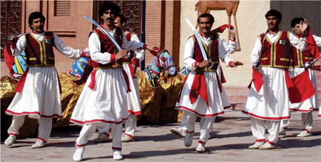
The Brahui is traditionally a tribal culture, justice is usually administered by tribal elders rather than the official Pakistani courts. The population is mostly rural and engaged in subsistence level farming and ranching. Marriages are normally arranged and women have few rights. Literacy rates are low, especially for women. Food is very similar to Balochi food and heavy on the mutton. Music and dance are valued as is hospitality. Religion is almost universally Sunni Muslim, though many of their social customs are more Indian than Muslim. More about Brahui culture.
The economy here is agriculture based, while it is very dry there are thin strips of fertile soils along the rivers. Major crops are wheat and barley, but a wide variety of fruits and vegetables are grown as well including olives when you get closer to Khuzdar. Keeping livestock is also common, mostly sheep and goats. There are also potential mineral resources in the area, elsewhere in the district there are some large Barium mines.
Khuzdar is the nearest place for pretty much everything. That would include schools, among others it is home to the Balochistan University of Engineering and Technology which looks to have a substantial campus. That would include sports, I can see stadiums for football and cricket. It is also home to numerous government offices, a military base, and an airport (albeit without any schedule commercial flights). There is a budding tourist industry here as well, though most of the district's tourist attractions (including some striking waterfalls and ruins of medieval forts) lie north of Khuzdar rather than south where our point is.
I didn't think I'd get any better views consider there is no streetview in this area, but then I came across this video of someone doing that drive from Karachi to Khuzdar which passes through Wadh - some great scenery shots, this road is running one valley to the west of the one where our point is.
https://www.youtube.com/watch?v=Yxywgn0axXY
You also get some glimpses of one of my favorite things about Pakistan, the totally blinged out trucks! So I'll leave you with that.

Physical geography:
It's hard to find any information about this place, which is a shame, because I suspect it looks spectacular. We're halfway up the side on a mountainous canyon, about 2,000 feet across and 1,000 feet deep, mostly bare rock, with a large, rushing river running down the bottom. Our elevation is 4,100 feet above sea level with the mountain going up to 4,500 and the bottom of the valley being around 3,800. The rocky promontory across from us is around 4,000 feet and overlooks a wide bend in the river and contains ruins of some ancient settlement. While I could not find a name for the mountain we're on it is part of the Brahui range which runs parallel and just to the west of the Kirthar Mountains that form the western edge of the Indus River Valley. The river is the Garo which flows into the Khadri into the Singhar into the Kolachi or Gaj which flows into the Indus about 150 miles away. The mountain across the river as named Shuk and both form part of a north-south ridge running some 200 miles from near the Arabian Sea coast into Central Asia where it ends at the Bolan Pass. Our point is about 135 miles from the sea.
The climate here is desert, with temps in the 90's in the summer, cooling off to the 50's in winter, on rare occasions dipping below freezing. Rainfall is minimal, averaging 10 inches a year, though that may be misleading, often it's 0, but sometimes monsoons off the Indian Ocean will make it this far inland and dump a bunch of rain as a single event, usually in July or August. The area had one such event just this past August and it caused major flooding. Vegetation is also minimal, though I imagine there are some shrubs among the rocks, and down along the river there is some greenery. I couldn't find any detailed info on the ecology, but imagine there are critters that like mountainous deserts, like the Ibex (pictured below), jackal, porcupine, and various smaller rodents. The area would be subject to wind storms.
This picture isn't particularly close to our point, but I think the landscape probably looks similar:
Human geography:
We are in the Wadh Tehsil (think township) of the Khuzdar District in the province of Balochistan in Pakistan. The nearest people to our point might be just across the river, there are some what look like ruins and some former fields, but they look abandoned, including the remains of what might've once been a bridge. Google labels the place as Gumbaz but that seems suspicious as no other maps I could find place a current settlement here and there's no transportation linking it to anything, nor could I find any historical references by that name (at least not at this location, there are other places that use that same name in Pakistan) so I don't know what this settlement was and it's possible there are still a few people there.
The actual town of Wadh is about 17 miles to the west, but might as well be a million as 10 of that is extremely difficult looking mountainous terrain with no passes through it. The more likely connection to the outer world is following the river to the east. About 6 miles downstream are small settlements of isolated farms that I also couldn't find a name for, but is clearly populated from the imagery, and about another mile there's a dirt track of a road that crosses the river. From that road it's 25 miles north or an hour drive to the district capital of Khuzdar. Khuzdar is a real city, 182,000 people, and with all your modern conveniences. It's the third largest in Balochistan, which is a pretty inhospitable and sparsely populated province in general. Khuzdar itself is still rather remote, with no commercial air or railway connections, it's a 4.5 hour drive to the north to Quetta or a 5.5 hour drive to the south to Karachi to get to a major metropolis.
This area has been inhabited since ancient times, the area, especially around Wadh, is dotted with Neolithic archeological sites. Not much is known about those ancient people, but they were probably connected with the people that became the Indus Valley Civilization. Since then the history of Balochistan has been a constant tug of war between Indian and Persian empires. When Alexander the Great conquered Persia it included the area. The Mauryan empire conquered it from the Greeks. The Parthians took it from the Mauryans. When the Mongols conquered Persia, the Baloch people that the province is named after we're pushed from southeastern Persia into the area coming into conflict with Indians.
When the Arab conquest swept through the area in the 7th century this became the eastern edge of the Caliphate and the locals converted to Islam. Arab rule lasted until the 10th century and was never all that solid, revolts were frequent. When the Caliphate broke up Balochistan became a part of a series of Persian dynasties up until Akbar began expanding the Mughal Empire into the region in the 1580's and local chiefs switched their allegiance to the Mughals without a fight. The Khanate of Kalat was established in 1666, subject to the Mughals until it became a British protectorate in 1839, and then losing more control to the British in 1876. When India won its independence Kalat was briefly independent before acceding to the new state of Pakistan. It remained a princely state within Pakistan until being dissolved in 1955. There is a Balochistan nationalist movement that has been periodically active since 1948 leading a low level insurgent conflict against Pakistan.
So who are the people that live here now? We already mentioned the Baloch people who are related to various Persian speaking peoples and on the neighboring lower Indus Valley you have the Sindh people, both of which are minorities in Pakistan who's largest ethnic group are the Punjabi. But most of the people living in Khuzdar, Wadh, and along our river are none of these, they are the Brahui people. The Brahui are an ethnic group of about 2 million people living in the mountains between the Baloch and the Sindh, they speak their own language which is more closely related to the languages of Southern India than either of their neighbors, though many of them also speak Balochi. The Brahui language normally uses Arabic script, but can be written using a Latin-based alphabet as well. Where the Brahui came from is unclear, they might've always been here, they may have migrated later, the linguistic and genetic evidence is conflicting. That they were always here seems likely to me, the various waves of conquest generally went around these mountains rather than through them and the area was always a frontier of whatever empire it was nominally a part of. They were certainly well established by the Khanate of Kalat period, which had a Brahui ruling family. Kalat had 3 provinces, one Baloch, one Sindh, and one Brahui, with the latter's capital at Khuzdar and Khuzdar remains the largest Brahui-speaking speaking city. Pakistan's official languages of Urdu and English are also used, especially in schools and in the media.
The Brahui is traditionally a tribal culture, justice is usually administered by tribal elders rather than the official Pakistani courts. The population is mostly rural and engaged in subsistence level farming and ranching. Marriages are normally arranged and women have few rights. Literacy rates are low, especially for women. Food is very similar to Balochi food and heavy on the mutton. Music and dance are valued as is hospitality. Religion is almost universally Sunni Muslim, though many of their social customs are more Indian than Muslim. More about Brahui culture.
The economy here is agriculture based, while it is very dry there are thin strips of fertile soils along the rivers. Major crops are wheat and barley, but a wide variety of fruits and vegetables are grown as well including olives when you get closer to Khuzdar. Keeping livestock is also common, mostly sheep and goats. There are also potential mineral resources in the area, elsewhere in the district there are some large Barium mines.
Khuzdar is the nearest place for pretty much everything. That would include schools, among others it is home to the Balochistan University of Engineering and Technology which looks to have a substantial campus. That would include sports, I can see stadiums for football and cricket. It is also home to numerous government offices, a military base, and an airport (albeit without any schedule commercial flights). There is a budding tourist industry here as well, though most of the district's tourist attractions (including some striking waterfalls and ruins of medieval forts) lie north of Khuzdar rather than south where our point is.
I didn't think I'd get any better views consider there is no streetview in this area, but then I came across this video of someone doing that drive from Karachi to Khuzdar which passes through Wadh - some great scenery shots, this road is running one valley to the west of the one where our point is.
https://www.youtube.com/watch?v=Yxywgn0axXY
You also get some glimpses of one of my favorite things about Pakistan, the totally blinged out trucks! So I'll leave you with that.